File:Permafrost layers.png: Difference between revisions
Jump to navigation
Jump to search
Diagram of tundra soils and permafrost Credit: Benjamin Jones, USGS. From: https://climatekids.nasa.gov/permafrost/#:~:text=and%20South%20Poles.-,Permafrost%20is%20any%20ground%20that%20remains%20completely%20frozen%E2%80%9432%C2%B0,large%20regions%20... |
(No difference)
|
Latest revision as of 15:43, 4 May 2021
Diagram of tundra soils and permafrost Credit: Benjamin Jones, USGS. From: https://climatekids.nasa.gov/permafrost/#:~:text=and%20South%20Poles.-,Permafrost%20is%20any%20ground%20that%20remains%20completely%20frozen%E2%80%9432%C2%B0,large%20regions%20of%20the%20Earth.
File history
Click on a date/time to view the file as it appeared at that time.
| Date/Time | Thumbnail | Dimensions | User | Comment | |
|---|---|---|---|---|---|
| current | 15:43, 4 May 2021 | 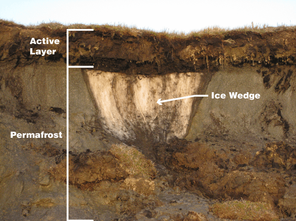 | 974 × 729 (482 KB) | Ddietric (talk | contribs) | Diagram of tundra soils and permafrost Credit: Benjamin Jones, USGS. From: https://climatekids.nasa.gov/permafrost/#:~:text=and%20South%20Poles.-,Permafrost%20is%20any%20ground%20that%20remains%20completely%20frozen%E2%80%9432%C2%B0,large%20regions%20... |
You cannot overwrite this file.
File usage
The following page uses this file: